HWS News
23 July 2024 • Research • STEM Geology of the Pacific Northwest
During a summer course, geoscience students and faculty traveled the coast and mountains of the Pacific Northwest exploring the geology, climatology, and aquatic science of the region.
This year’s GEO 299 field study course exposed students to a wide range of geological formations and scientific techniques as they explored Washington and Oregon.
Led by Associate Professors of Geoscience Tara Curtin and Dave Finkelstein, the intensive 12-day field excursion began with an up-close study of Mt. St. Helens, where the group observed evidence for volcanic eruptions from nearly 2,000 years ago, as well as the May 1980 eruption along the west side of the mountain.
On the Oregon coast, students investigated the evolution of sandy and rocky shorelines before traveling inland to analyze and compare the chemistry of several lakes as they traversed the Coast Range and the Cascade Mountains to the high desert. In central Oregon, the group visited the headwaters of the McKenzie River, the Newberry Volcanic complex and Crater Lake, where students reconstructed the events that formed the deepest lake in the U.S.
Here’s a glimpse of the formations they explored and connections they made from textbook to landscape.
Offered annually, the GEO 299 course immerses students and faculty in field research, with mapping and data collection projects that put classroom learning into practice. Previous courses include the studies of the geological formations of Caribbean islands and storm-chasing in the Midwest.
GEO 299
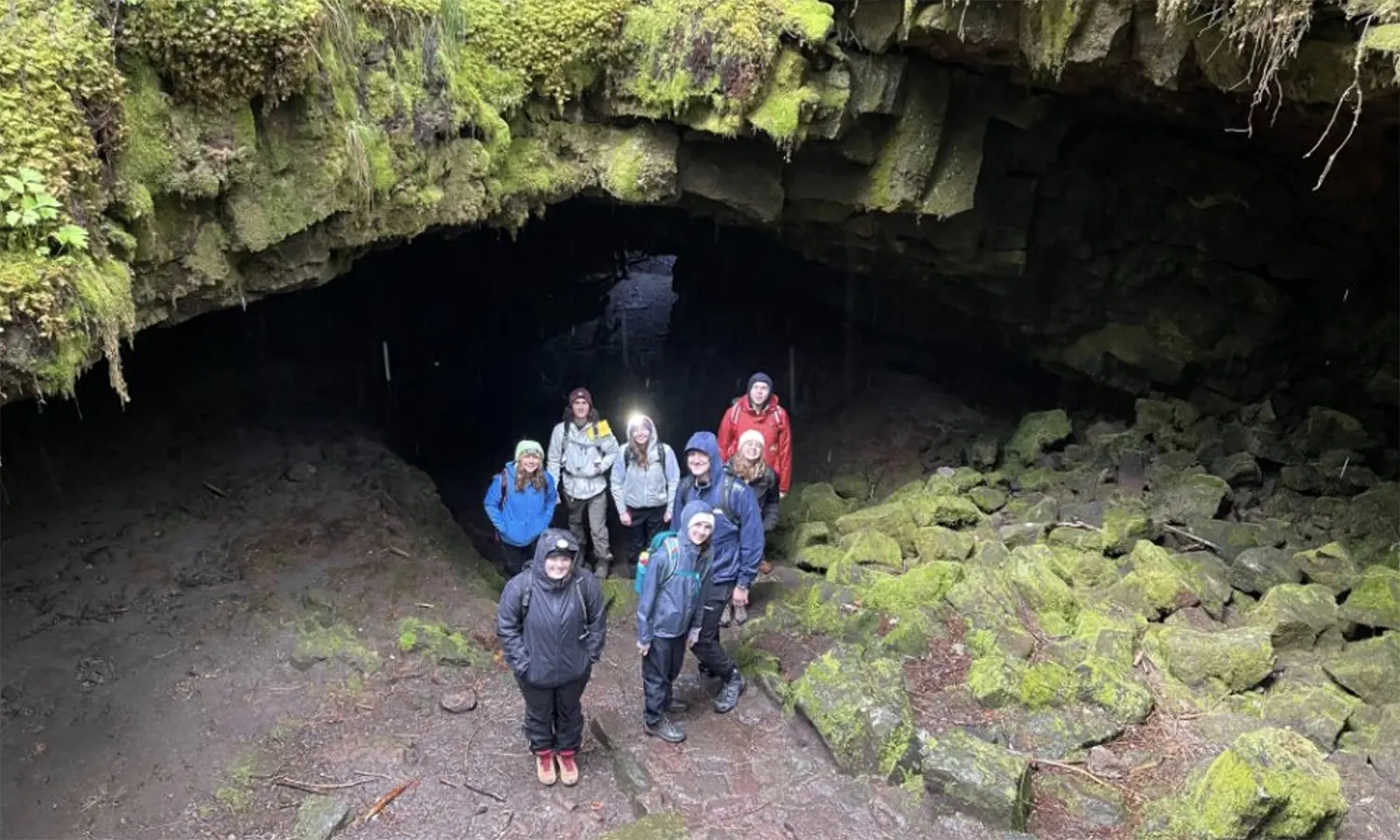 In Washington, students strap on headlamps to explore Ape Cave, a series ancient of lava tubes within sight of Mt. St. Helens.
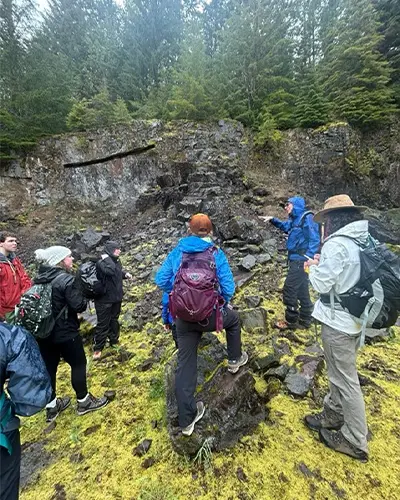 At Volcano Viewpoint Quarry in Washington, Professor Finkelstein helps students document the rock types and textures to identify earlier lava flows in the Mt. St. Helens region.
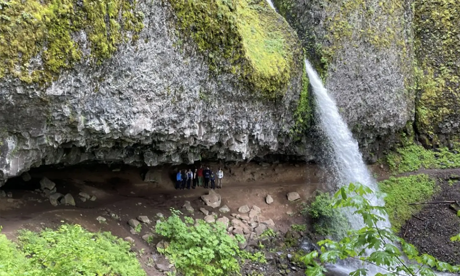 Identifying the regional lava flows outside of Portland, Ore., the group examines the textures of columnar basalts behind a waterfall.
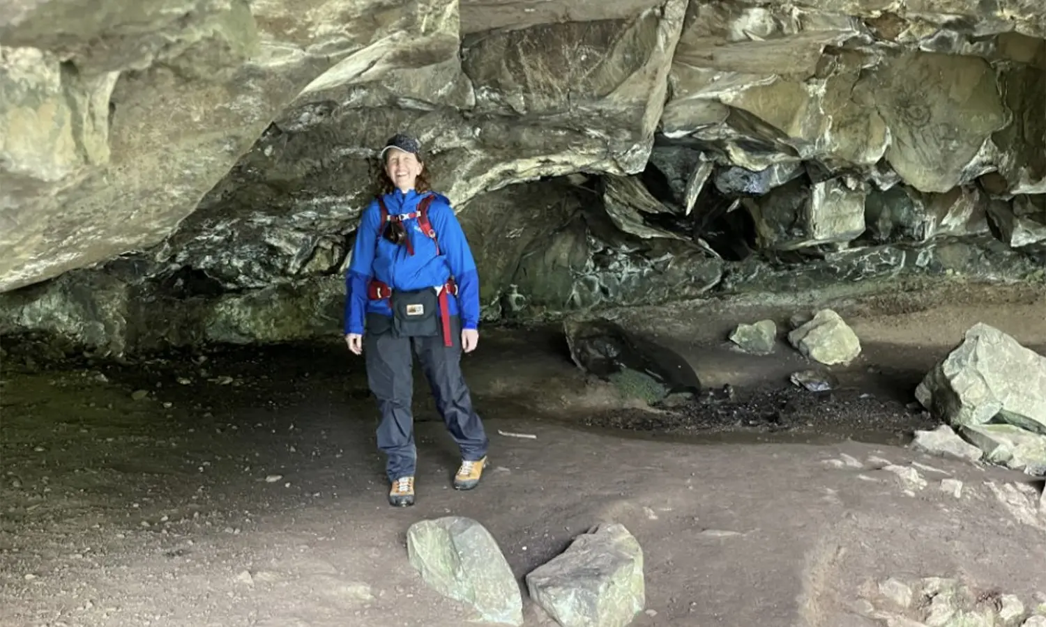 Associate Professor of Geoscience Tara Curtin notes the scale of the underside of the flow and its development.
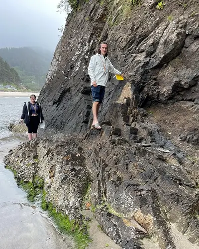 At Neskowin Beach, Ore., Ava Dimitroff ’25 and Eric Koon ’24 characterize a sea stack and dike at the beach.
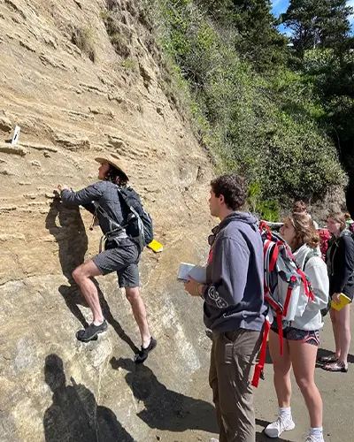 Documenting reverse and normal faulting within the accretionary wedge along the Oregon coast: Eric Koon ’24, Mikyle Polcari ’27, Delilah Heutsche ’26 and Ava Levinson ’26 identify marker beds to determine relative movements of the rock layers adjacent to the faults.
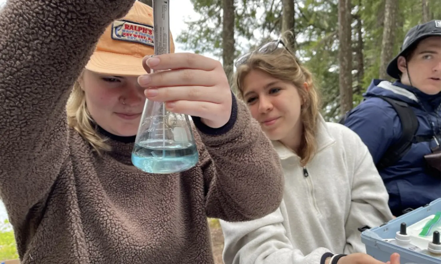 Ava Dimitroff ’25, Delilah Heutsche ’26 and Noah DeLong ’27 work on the alkalinity titration to determine bicarbonate from Clear Lake.
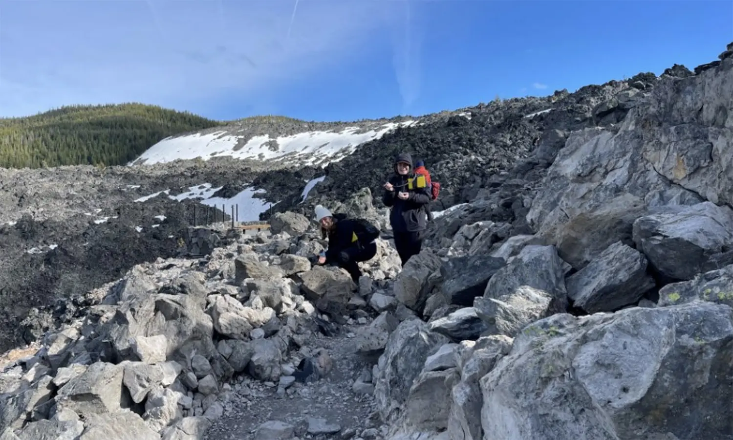 Ava Dimitroff ’25 and Delilah Heutsche ’26 identify the different textures within the obsidian flows of the Newberry Volcanic complex.
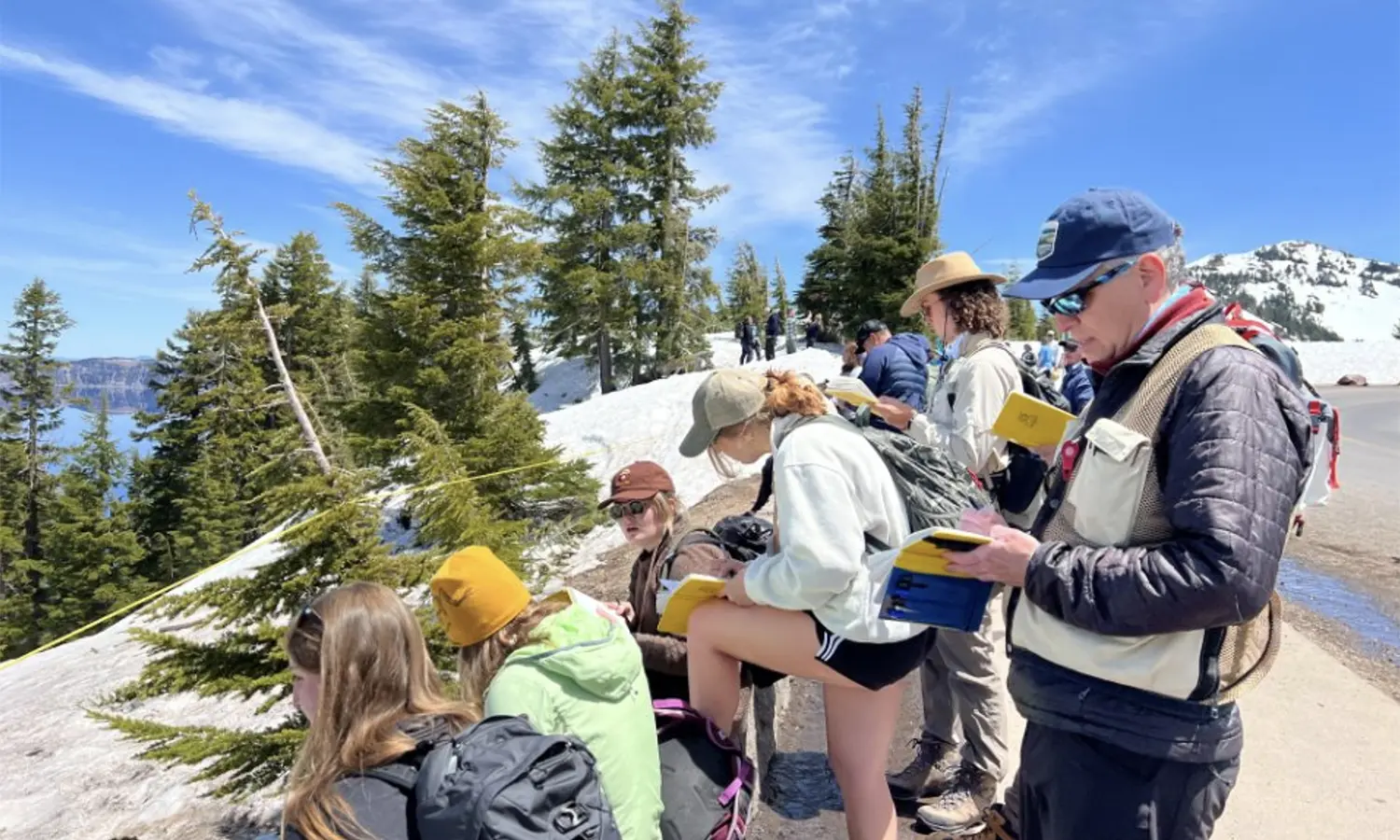 The group creates a sequence of events that formed Crater Lake and Wizard Island.
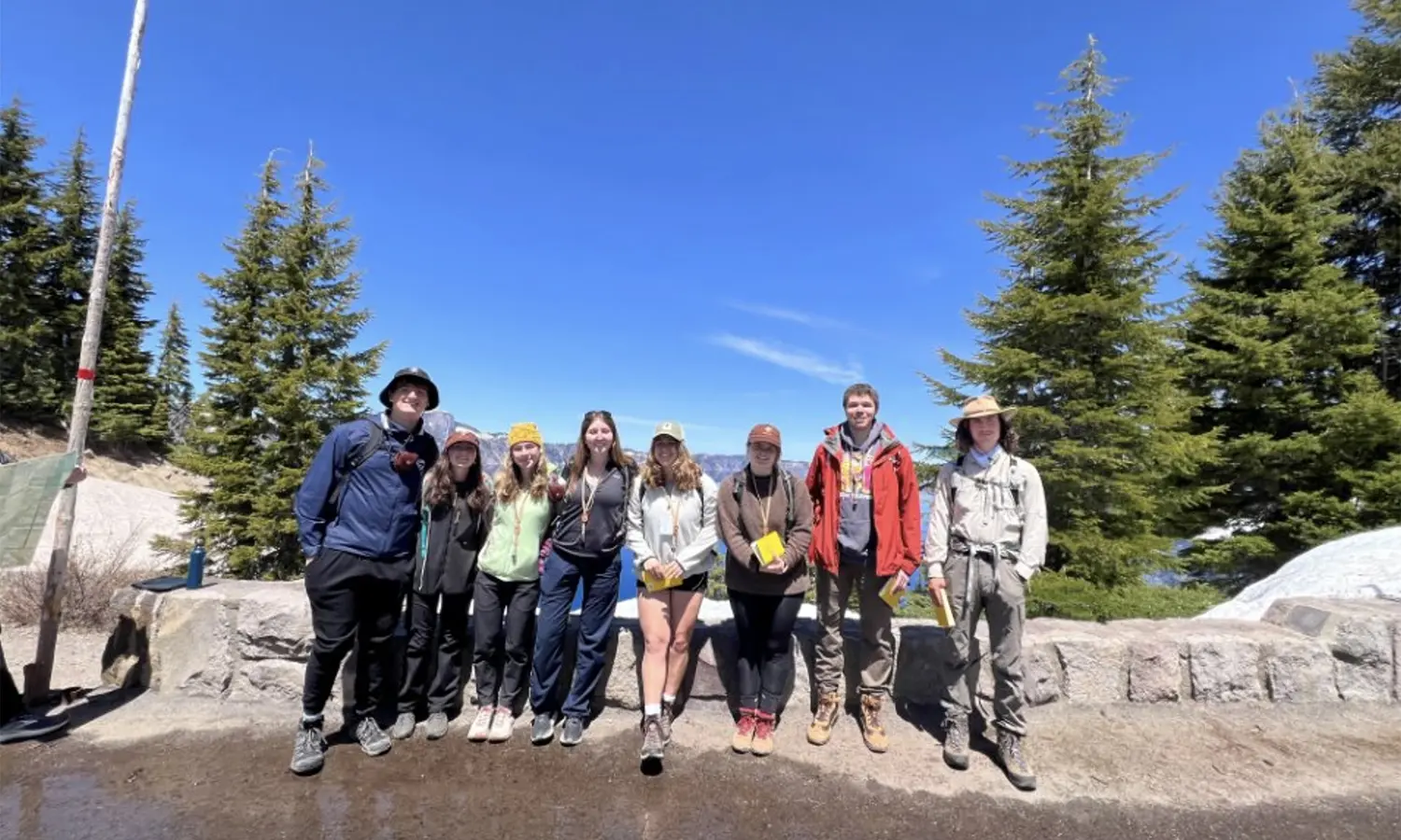
- Two weeks and 1,500 miles later, Ali Kirk (Whitman College ’27), Ava Dimitroff ’25, Ava Levinson ’26, Caroline Gharibian ’27, Delilah Heutsche ’26, Eric Koon ’24, Mikyle Polcari ’27 and Noah DeLong ’27 enjoy a quiet moment above Crater Lake.
Top: Two weeks and 1,500 miles later, Ali Kirk (Whitman College ’27), Ava Dimitroff ’25, Ava Levinson ’26, Caroline Gharibian ’27, Delilah Heutsche ’26, Eric Koon ’24, Mikyle Polcari ’27 and Noah DeLong ’27 enjoy a quiet moment above Crater Lake.